Our coral reef research in the Tuamotu archipelago began with an aerial survey, at an elevation of 500-1000 feet above sea level, using the Golden Eye seaplane. The Tuamotu islands constitute the largest archipelago in French Polynesia, spanning an area that is similar in size to western Europe (but with a land area of only about 850 km2), and including 77 of the 425 atolls of the world. Our surveys focus on Rangiroa, Aratika, Raraka, Fakarava, Toau and Niau, a group of atolls that form the Pallisers Islands, at the northwest end of Tuamotu.
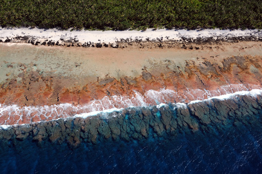
The Tuamotu Archipelago
The Tuamotus are geologically the oldest islands in French Polynesia, formed atop a huge ridge that extends at a depth of 1,500 to 3,000 m, and surrounded by deeper (4000-5000 m) water. From the air, they look very different from many of the Society Islands. There are no high volcanic islands like Tahiti, Raiatea and Huahine. They are true atolls, built by the growth of coral and coralline algae that caps the tops of submerged inactive volcanoes. Most of the islands in the Tuamotu archipelago are only a few meters above sea level, except for Makatea and parts of Rangiroa, Fakarava, and Niu, which were once submerged but have been uplifted by tectonic movements and are now rimmed by carbonate (limestone) cliffs. Their location and structure is influenced by movement of the seafloor, changes in sea level, and wave action.
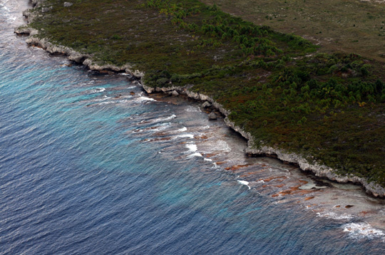
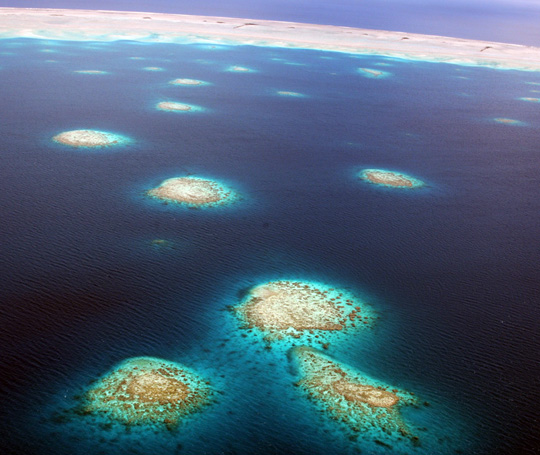
Our first stop was Rangiroa, the largest atoll in French Polynesia and second largest in the world. It has a total area of about 1400 km2, more than 240 motu (Polynesian name for small islands), two deep channels or passes (called “ava” in French Polynesia), and numerous small inlets (called “hoa” French Polynesia) that are often partially or fully isolated from the sea. Because of its size, Rangiroa lagoon functions more like an inland sea than a true lagoon. Rising from the floor of the lagoon (20-25 m deep), to just below the water’s surface, numerous coral bommies or pinnacles are scattered throughout the lagoon, forming an intricate reticulate network of reefs. Like the islands, these coral patches can have a sheltered side and exposed side, each with different animals and plants.
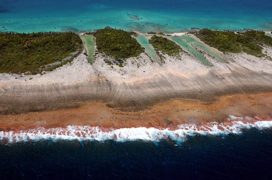
After refueling, we headed east, circling the perimeter of Aratika and Raraka, followed by Fakarava, and Toau. All of these islands in the Tuamotu archipelago have ava of varying size connecting the lagoon to the sea, but only two (in Fakarava and Toau) are large enough to allow safe passage of the Golden Shadow. The degree to which these lagoons are enclosed, and the type and size of the passages are key features affecting the circulation and flushing of the lagoon, the transport of sediments from the lagoon to the outside, and what types of corals, fishes and other animals live in the lagoon.
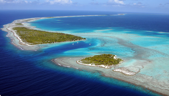
Fakarava, the second largest atoll in the Tuamotu archipelago (approx. 1200 km2), has an extensive deep lagoon connected to the ocean by two deep channels. The main pass to enter the lagoon, located at north-western end (Passe Garuae) is the largest channel in French Polynesia and is famous dive destination for shark observations. Within the lagoon are hundreds of coral bommies and pinnacles, mostly concentrated at the southern and central parts of the lagoon; these are best developed and often have small emergent sand islands in the central area.
We finished our aerial reconnaissance of the Tuamotu archipelago at Niau, a completely enclosed atoll with a shallow swampy hypersaline lagoon, dark green in color, dense vegetation encircling the perimeter, sandy beaches and a fringing reef. After refueling in Rangiroa, we headed back to Tahiti to meet the rest of the scientific team and begin our surveys of Tuamotu’s coral reefs.
(Photos by: Dr. Andy Bruckner)
To follow along and see more photos, please visit us on Facebook! You can also follow the expedition on our Global Reef Expedition page, where there is more information about our research and team members.