Findings from the Global Reef Expedition
What we learned assessing the health and resiliency of coral reefs around the world
Findings from the Global Reef Expedition
What we learned assessing the health and resiliency of coral reefs around the world
What We Found
The State of the World's Coral Reefs
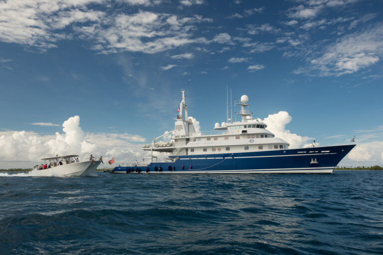
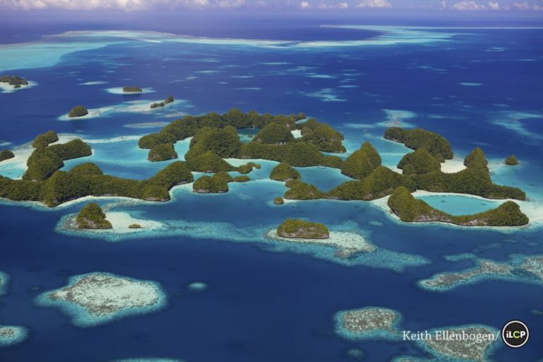
The Global Reef Expedition (GRE) was one of the largest coral reef research missions ever conducted. Over ten years, hundreds of scientists from the Khaled bin Sultan Living Oceans Foundation and our partners surveyed reefs in 16 countries across the Atlantic, Pacific, and Indian Oceans, as well as the Red Sea. Together, we collected standardized data on the health and resilience of coral reef ecosystems, creating a comprehensive global dataset — a snapshot of the state of the world’s coral reefs at a critical point in time.
This ambitious project revealed not only the diversity and beauty of reefs but also the mounting threats they face from overfishing, pollution, and climate change. The results are now being used by researchers, policymakers, and conservationists around the world to protect and restore coral reefs.
RESEARCH FINDINGS
Climate Change Is the Greatest Threat to Reefs
Findings from the Global Reef Expedition confirm that climate change poses the most significant and widespread threat to coral reefs globally. Rising sea temperatures are leading to more frequent and severe coral bleaching events, which weaken reef resilience, reduce biodiversity, and alter reef structure and function.
One of the most striking examples came from the Chagos Archipelago, located in one of the most remote and protected parts of the Indian Ocean. Despite its isolation and minimal local human pressure, Chagos experienced widespread coral bleaching during the GRE surveys. This event illustrates a critical point: no reef is too remote to escape the impacts of climate change. The warming of ocean waters is reaching even the most pristine ecosystems, eroding the myth that distance from human populations offers protection.
The GRE’s data underscores the urgent need for global action to mitigate climate change and enhance coral reef resilience.
Overfishing Is a Major Driver of Reef Fish Decline
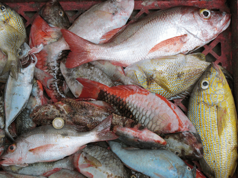
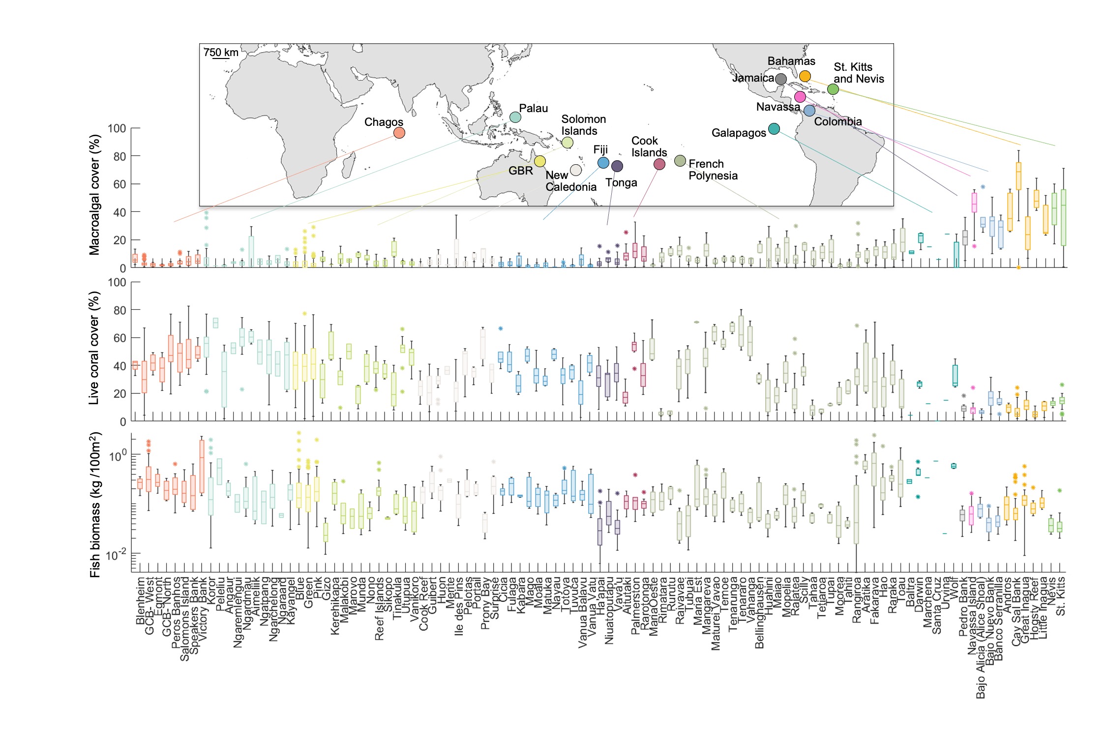
The Global Reef Expedition found that overfishing has severely reduced reef fish populations in many of the regions surveyed. Most sites were dominated by small fish, with very few large predators like groupers, snappers, and sharks. This loss disrupts reef food webs and weakens ecosystem health.
In the Caribbean, the impact was especially clear. The region showed some of the lowest fish biomass levels recorded during the expedition. Large herbivores and apex predators were scarce or entirely missing, a sign of long-term fishing pressure.
These findings highlight the urgent need for better fisheries management and marine protected areas to restore balance and support reef recovery.
Acute Disturbances: Sudden Threats to Coral Reefs
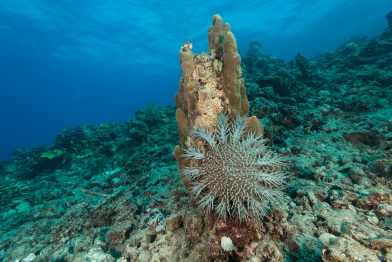
During the Global Reef Expedition, scientists observed that acute disturbances such as coral diseases, storm damage, and outbreaks of predatory starfish continue to devastate coral populations, compounding long-term threats like climate change and overfishing. These rapid and often unpredictable events can cause widespread coral mortality and reduce the ability of reefs to recover.
A striking example we observed was outbreaks of crown-of-thorns starfish (COTS), a coral-eating predator found across the Indo-Pacific. The Expedition recorded large-scale infestations in Tonga, Fiji, the Cook Islands, French Polynesia, and the Solomon Islands, where dense aggregations of COTS caused extensive coral loss.
To better understand the outbreaks, scientists collected and examined 1,321 individual crown-of-thorns starfish. This research supported studies on their biology, population dynamics, and the environmental factors driving their propagation.
These acute events serve as a reminder that even healthy reefs are vulnerable to sudden disturbances, and effective monitoring and management are essential to reef resilience.
Marine Protected Areas: A Proven Tool for Reef Recovery
The Global Reef Expedition found clear evidence that well-managed Marine Protected Areas (MPAs) support healthier coral reefs and more abundant fish communities. Surveys in places like Palau and the Great Barrier Reef consistently showed higher coral cover, greater fish biomass, and the presence of larger top predators compared to unprotected sites.
A focused study on the Great Barrier Reef, published as part of the GRE’s scientific outputs, confirmed that fish biomass was significantly higher in no-take reserves, especially for key predatory species. The study found that these benefits were strongest in older and strictly enforced MPAs, proving that protection takes time and commitment to deliver measurable ecological gains.
From Field to Forecast: How GRE Data Powers Coral Resilience Models
Through a collaboration with scientists from the University of Miami, the Global Reef Expedition’s field data was used to develop cutting-edge models that predict coral reef health and resilience across the Pacific. These resilience studies, published in peer-reviewed journals, combined extensive field surveys from over 650 reef sites with remote sensing data to identify key drivers of reef condition, such as temperature stress, human pressure, and habitat type.
The research confirmed that remote sensing tools, calibrated with GRE data, can accurately forecast reef health, even in areas not yet surveyed. The findings are now helping conservationists and policymakers prioritize reef protection and restoration efforts, making GRE data a cornerstone for strategic, science-based coral reef conservation.
Community Engagement: A Key to Lasting Reef Conservation
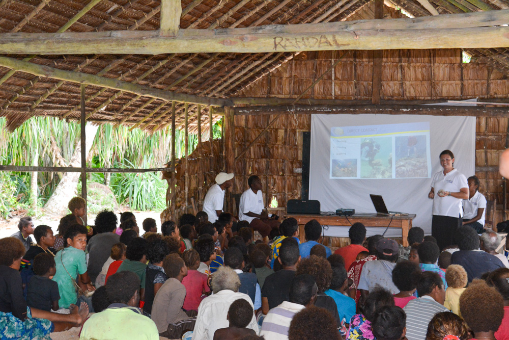
One of the most impactful lessons from the Global Reef Expedition was that working directly with local communities is essential to effective coral reef conservation. In the South Pacific, across places like Fiji, Tonga, the Cook Islands, and the Solomon Islands, the GRE team partnered with community and traditional leaders to ensure scientific findings were not only shared but also culturally relevant and actionable.
GRE scientists conducted outreach events in each country, engaging schools, churches, youth groups, and fisheries officers. Importantly, they also captured traditional ecological knowledge, incorporating local insights into reef health, seasonal patterns, and historical changes. This exchange built trust and opened the door for co-management approaches, where community members took ownership of reef stewardship informed by both science and tradition.
The result was deeper community buy-in, better-informed marine spatial planning, and, in some locations, the establishment or expansion of locally managed and marine protected areas rooted in both local priorities and ecological data.
Global Reef Expedition Final Report
Our findings are compiled in the Global Reef Expedition Final Report, which brings together years of research into one comprehensive resource. The report details the status of reefs across all regions surveyed, highlights lessons learned, and offers science-based recommendations to protect coral reefs worldwide.
DATA ARCHIVE
A Global Benchmark: Explore the Global Reef Expedition Data Archive
The Global Reef Expedition (GRE), led by the Khaled bin Sultan Living Oceans Foundation from 2006 to 2015, produced one of the most extensive and standardized coral reef datasets ever collected. Scientists surveyed over 1,000 reefs across 16 countries, generating a global baseline of coral reef health and reef fish populations. This data is publicly available and continues to support reef conservation, management, and scientific research worldwide
DATA ARCHIVE
A Global Benchmark: Explore the GRE Reef Data Archive
The Global Reef Expedition (GRE), led by the Khaled bin Sultan Living Oceans Foundation from 2006 to 2015, produced one of the most extensive and standardized coral reef datasets ever collected. Scientists surveyed over 1,000 reefs across 16 countries, generating a global baseline of coral reef health and reef fish populations. This data is publicly available and continues to support reef conservation, management, and scientific research worldwide
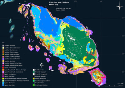
Habitat & Bathymetric Mapping
- 65,000 km² of high-resolution shallow marine habitat and bathymetry maps created using WorldView2 satellite imagery
- ~11,000 drop-cam videos capturing benthic habitats and annotated with location, depth, date, and environmental conditions
- 31 million acoustic water depth soundings
- Coverage includes the Red Sea, Caribbean, Pacific, and Indian Oceans
- World Reef Map: Interactive, online access to habitat maps
- Atlases Available: Saudi Arabian Red Sea, Bahamas
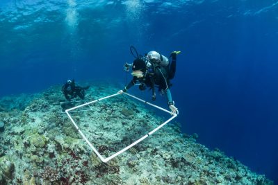
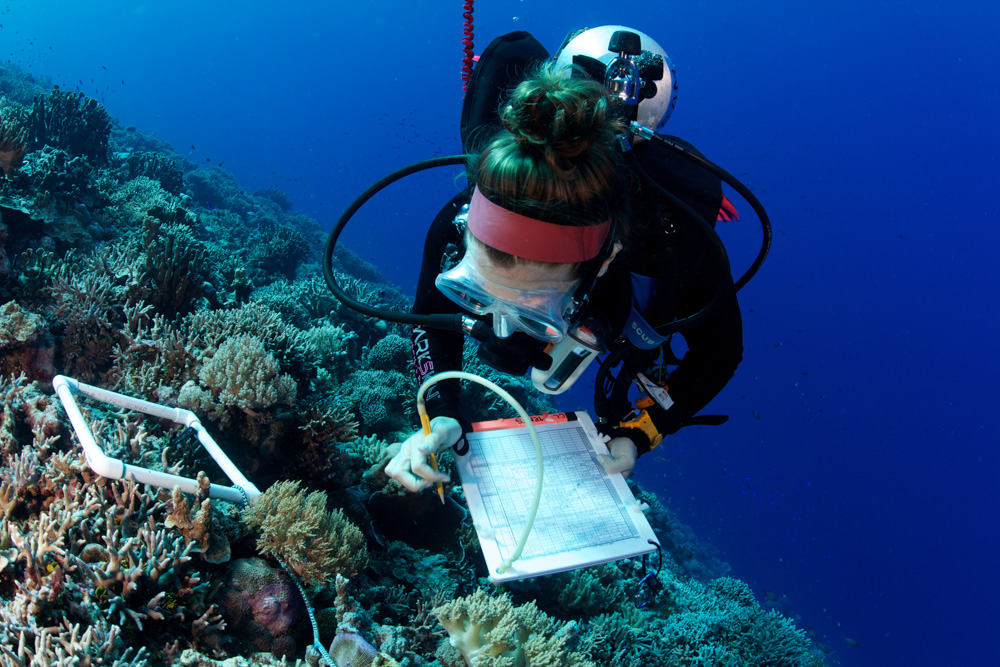
Benthic Community Surveys
- ~8,500 benthic surveys at over 1,000 sites
- ~4,600 photo transects
- Assessments of live coral cover, algae, substrate type, and benthic invertebrates
- Coral diversity documented to genus or species level
- Data supports regional and global reef health comparisons
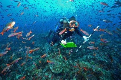
Fish Community Surveys
- ~8,300 fish surveys at over 1,000 sites
- Fish identified by species and size, with biomass and density calculated
- Focus on commercially and ecologically important species
- Data used to evaluate fishing pressure and reef trophic structure
Request the Use of Our Data
The Living Oceans Foundation provides opportunities for scientists, governments, and conservation organizations to use our data to protect coral reefs and other coastal marine ecosystems. If you are interested in using our data to support your marine conservation initiatives, we invite you to fill out a data request form to access these valuable resources.
Atlases
The Khaled bin Sultan Living Oceans Foundation published several regional atlases that compile our scientific findings and high-resolution habitat maps into a single, easy-to-use reference. These atlases are designed to support marine managers and government officials in making informed decisions about coastal planning and conservation.
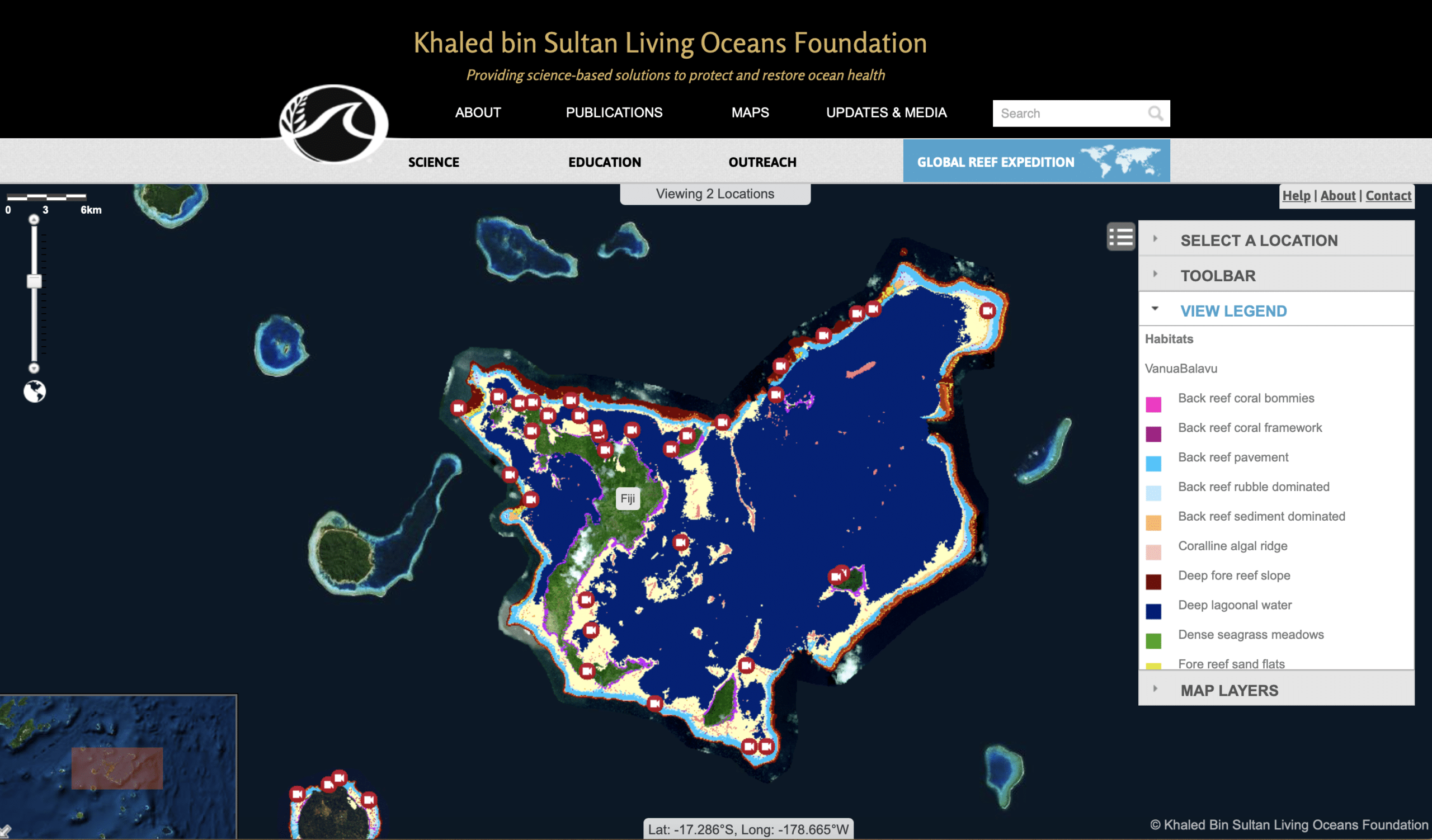
World Reef Map
Our interactive World Reef Map allows you to dive into the data yourself. Explore detailed habitat and bathymetric maps created from satellite imagery and field data, covering more than 65,000 square kilometers of shallow-water marine habitat.
Latest Updates