Emily and Irene: A Tale of Two Storms
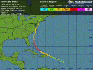
Prior to beginning our research at Little Inagua, we knew there was some “weather” occurring in the eastern Caribbean that we had to keep our eyes on. At first, we thought we could leave one day early, transit back to