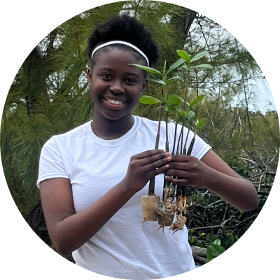
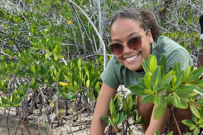
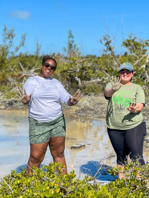
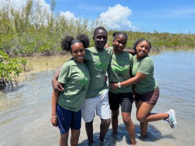
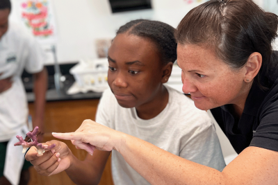
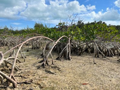
Posts Tagged ‘Bahamas’

The Legacy Site – What Will the Future Tell?

Friday, October 12th, 2012

October 11th, 2012

Written by Candice Jwaszko

The Khaled bin Sultan Living Oceans Foundation works on a global scale to improve our understanding of coral reef health and the ecological integrity of coral reef ecosystems. Pollution, coastal development, overfishing, climate change, disease, and predation can negatively impact coral reefs. To see how reefs change over time as a result of these and other factors, scientists set up “Legacy sites”, observational areas that can be compared over time. These sites can provide incredible insight into the future of coral reefs, and their resiliency to ecological disturbances.

Society Islands Legacy Site

Society Islands Legacy Site

Read the rest of The Legacy Site – What Will the Future Tell? »

Under Pressure and Headed Home

Thursday, October 6th, 2011
October 6, 2011

Conducting a research expedition in the Bahamas during hurricane season (June 1 – November 30) can be a risky venture.  One never knows where or when a tropical storm (which is a low pressure system) will develop.  Depending on the size and intensity of the storm, sometimes it’s simply a matter of moving your expedition out of the way of the expected path.  Sometimes you have to steam for safe harbor and fly your researchers out of harm’s way, which was the case for the end of the Inaguas and Hogsty leg of the Bahamas Expedition (click here to read the blog “Irene and Emily:  A Tale of Two Storms”).

Deploying the RDCP in flat calm water.  Left to right:  Amanda Williams, Dr. Andrew Bruckner, CAPT Phil Renaud

Deploying the RDCP in flat calm water. Left to right: Amanda Williams, Dr. Andrew Bruckner, CAPT Phil Renaud


However, when a high pressure systems develops over a coral reef researcher’s expedition area, no one thinks of calling it off.  High pressure systems are areas of fair weather and blue skies.  Unfortunately, an area with extremely high pressure may bring some pretty intense winds.  Yesterday, a cold front began passing through the Bahamas.  Behind the front is an area of very high pressure.  The winds we experienced before the front were very calm and the sea state (wave height) was nearly flat calm.  Since the cold front, the winds have increased to more than 20 knots (22 m.p.h.) and the sea state is around 2 m (6.5 feet).  Over the next week the winds are expected to increase and become sustained at 30 knots (33 m.p.h).   By the way, tropical storm force winds begin at 34 knots.  This will increase the seas to 3 m (10 feet) or more.

Read the rest of Under Pressure and Headed Home »

A Male’s Tale

Wednesday, October 5th, 2011
October 5, 2011

Due to repetition, most of the time each of our reef fish surveys is similar to the previous survey.  This is not unusual.  One of the purposes of doing such studies is to find the “typical” species composition, sizes, and abundance of fish one would find in a given area.  Special note may be taken on out of the ordinary observances.  This recently occurred when members of our fish research team, Ken Marks and Dave Grenda, were reviewing some data taken on the Spanish Hogfish (Bodianus rufus).


Spanish Hogfish Juvenile Phase

Spanish Hogfish Juvenile Phase


Spanish Hogfish are in the wrasse family (Labridae).  Like other wrasses, the juveniles play a major environmental role on the reef as “cleaners”.  This means that they feed on the parasites and dead tissues on larger fish.  Often, they will find a prominent area on the reef, such as a coral head, and set up a “cleaning station” that larger fish recognize and will visit for cleaning.  As they mature, Spanish Hogfish root around in the sediment with their snouts, like a hog.  They eat benthic invertebrates such as brittle stars, urchins, crustaceans, and mollusks.

A Brittle Star

A Brittle Star


Read the rest of A Male’s Tale »

A Monkey Wrench in the Gears of ScienceFun

Tuesday, October 4th, 2011

October 4, 2011

Rest assured life as a coral reef ecology researcher is not always glamorous.  Sometimes it’s not easy to be a marine scientist.  Sometimes a plan does not always come together. For example, the Chief Scientist, Dr. Andrew Bruckner, has two weeks to accomplish his plan to wrap up the Foundation’s last leg of the Bahamas Expedition.  Three or four dives a day is the plan for most of the next two weeks.  Sunday was no exception. There are ten scientists that work in two person buddy teams.  Each scientist has their own set of surveying criteria and goals that they must repeat for each 65 minute dive (click here to read the Science Plan).  The research team readied their gear, while Dr. Bruckner and Amanda Williams scouted out the first dive site.

Dr. Andrew Bruckner and Amanda Williams scouting research dive sites.

Dr. Andrew Bruckner and Amanda Williams scouting research dive sites.

   Read the rest of A Monkey Wrench in the Gears of ScienceFun »

Underway, Making Way

Sunday, October 2nd, 2011

October 2, 2011

The third and final leg of the Bahamas’ expedition left the dock at Nassau around 8 pm last night.  The research team was all assembled on the Golden Shadow by 5:30 pm and had a safety muster on the aft deck.  Remember, safety is no accident.  After a great dinner, the scientists prepared for the research ahead.

Jeremy Kerr (right) and Anesti Stathakopoulos (left) are preparing the ground truthing gear.

Jeremy Kerr (right) and Anesti Stathakopoulos (left) are preparing the ground truthing gear.


After steaming south all night we arrived at the southern tip of Andros Island.  Actually, Andros Island is an archipelago, or chain, of three different islands.  The islands are North Andros, Mangrove Cay, and South Andros.  Tidal creeks, or bights, separate the islands.  Due to the narrow separations, most people consider them one island.  Andros Island is the largest in the Bahamian archipelago.  It is 104 miles (167 km) long and at its widest is 45 miles (72 km).  The west side of Andros is known for its extensive mangroves, seagrass, and sand flats.  Andros’ interior boasts the world’s largest collection of blue holes.  Blue holes are usually circular vertical caves that can be quite deep and extensively connected.  They are the result of erosion when the islands of the Bahamas were exposed during ice ages throughout geologic history.  At some points the sea level dropped as much as 390 feet (119 m).  There are almost 200 blue holes on Andros Island. Read the rest of Underway, Making Way »

Emily and Irene: A Tale of Two Storms

Wednesday, August 31st, 2011

August 31, 2011

Prior to beginning our research at Little Inagua, we knew there was some “weather” occurring in the eastern Caribbean that we had to keep our eyes on.  At first, we thought we could leave one day early, transit back to Nassau, and avoid the storm.  However, when we awoke the morning of August 22nd, Captain Steve informed us that the questionable weather off to the east was blowing up into a Tropical Storm… known as Irene.

The path of Hurricane Irene

The path of Hurricane Irene

  Read the rest of Emily and Irene: A Tale of Two Storms »

Spawning Sponges at Little Inagua

Tuesday, August 30th, 2011

August 30, 2011

From August 19th-22nd, we experienced nothing but great wall diving around Little Inagua, which is always a diver’s delight.  The island of Little Inagua is five miles to the northeast of Great Inagua, and hosts a large Land and Sea Park. The island is 30 square miles and home only to herds of feral donkeys and goats, descendants of stock introduced by the French.   A protective reef surrounds Little Inagua on all sides, beginning at 14m depth and dropping nearly vertically to the ocean floor.


Nearly vertical wall off Little Inagua

Nearly vertical wall off Little Inagua

The winds come from the southeast in the summertime creating 4-6 foot swells and making scuba surveys on the south and east facing coastlines nearly impossible. Charts show the north and south ends of the island as sheer drop-offs with reefs almost exclusively on the east and west coasts.  This layout combined with the windy weather limited our research capabilities around Little Inagua to mostly the north and west sides.

Read the rest of Spawning Sponges at Little Inagua »

Regionally Rare, Locally Abundant

Friday, August 19th, 2011

August 18, 2011 

Throughout most of the Caribbean, there are species of coral that are common and easily spotted on a dive, and those that are rare and difficult to locate.   Experienced divers can usually characterize a reef fairly quickly based on the types of corals growing there.  Some common corals that are generally easy to find include star corals (Montastrea sp.), starlet corals (Siderastrea sp.) and brain corals (Diploria sp.).  On the other hand, pillar corals (Dendrogyra cylindrus) and staghorn corals (Acropora cervicornis) are generally quite rare.  The corals of Hogsty Reef and Great Inagua have so far not followed this formula.  Living Oceans Foundation researchers have seen an unusually high number of rare corals.  Specifically, pillar corals appear to be thriving on the reefs here and staghorn corals are demonstrating remarkable resilience.  

Pillar coral (Dendrogyra cylindrus) is not a rare find around the Inaguas

Pillar coral (Dendrogyra cylindrus) is not a rare find around the Inaguas

Read the rest of Regionally Rare, Locally Abundant »

Surveying with Sound Waves

Thursday, August 18th, 2011

August 17, 2011

Ten days ago scientists and crew from the Golden Shadow deployed a piece of equipment known as a Recording Doppler Current Profiler (RDCP).  Today, team members collected it from the waters off the western side of Great Inagua.  The RDCP, a type of acoustic Doppler profiler, has been suspended over the sea floor collecting data at regular intervals to provide the expedition with some critical information that would be difficult, if not impossible, to collect manually.  The RDCP measures how fast water is moving as it passes over a set point from the sea floor to the surface; a vertical span is known as the water column.  A secured RDCP can measure the speed of the current at regular intervals from its anchorage to the surface.  The RDCP uses acoustic (sound) waves to measure water currents.  Like a dolphin using echolocation, the device sends out a series of pings.  These waves of sound bounce off of the surrounding environment and return to the instrument where any change in pitch is recorded.


The Recording Doppler Current Profiler (RDCP) suspended in the water column

The Recording Doppler Current Profiler (RDCP) suspended in the water column

Read the rest of Surveying with Sound Waves »

The Lionfish Predicament

Tuesday, August 16th, 2011

August 15, 2011

Although no one knows for certain how they came to be in the Caribbean Sea, lionfish are probably here to stay.  Living Oceans Foundation research divers have noted lionfish on every dive in Great Inagua and Hogsty Reef so far.  Atlantic and Gulf Rapid Reef Assessment (AGRRA) surveys first detected lionfish around Andros Island, Bahamas in 2007, although they may have been present prior to that date.  Since then, their numbers have been steadily rising, as has the size of the individual lionfish observed during survey dives.  Today, lionfish are present throughout the Caribbean.  In fact, lionfish have been spotted in the Western Atlantic Ocean as far north as Rhode Island, and as far south as Colombia.


Lionfish photographed on the reefs around Great Inagua, Bahamas

Lionfish photographed on the reefs around Great Inagua, Bahamas

Read the rest of The Lionfish Predicament »

GRE Website YouTUBE Channel Follow on Facebook Follow on Twitter RSS Feed Updates LOF Website

Search

Calendar

May 2013
M T W T F S S
« Apr    
 12345
6789101112
13141516171819
20212223242526
2728293031  

Archives