search-icon
Getting to the bottom of things

One of our survey methods that we do while diving at each site is photo transecting. Photo transects involve taking evenly measured photos of the reef bottom. This not only gives us a permanent record of the reef condition, but it also allows us to do a more detailed analysis after the dive. Executive Director Phil Renaud, Chief Scientist Andy Bruckner and Ken Marks have been taking photo transects on this trip to Rangiroa. Combined they take several photo transects every 5 meters from 30 to 5 meters depth.

Ken Marks taking photo transects.
A coral filled quadrat.
A screenshot of one of the programs used to analyze photo transects.


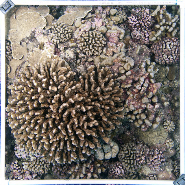
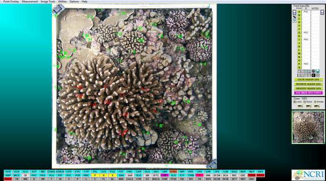
Each photo they take covers one square meter of reef. Using these photos, in combination with various computer programs, we can calculate the percentage of each organism on the bottom, the different sizes of corals or even the total area covered by coral. Photo transects are just another tool we have to help us describe and evaluate these reefs.

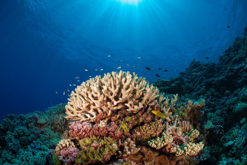
(Photos by 1-Brian Beck, 2-Ken Marks)

To follow along and see more photos, please visit us on Facebook!

Related Posts

World Oceans Day: Protecting the Ecosystems That Protect Us

This World Oceans Day, the global community is being challenged to think differently about the ocean.

The 2026 World Oceans Day theme, “Reimagine: Beyond the World We Know, A New Relationship With Our Ocean,” invites us to recognize that the ocean is not something distant or separate from our lives. It regulates our climate, supports our economies, provides food for billions of people, and sustains the natural systems that make life on Earth possible.

Few places illustrate this connection more clearly than the coastal ecosystems that protect our shores and support marine life. While coral reefs, mangrove forests, and seagrass meadows are often…

Read More

After the Storm: Standing with Our J.A.M.I.N. Family in Jamaica

There are moments in this work that feel heartbreakingly familiar.

Two weeks after we completed our Jamaica Awareness of Mangroves in Nature (J.A.M.I.N.) programming, Hurricane Melissa made landfall. A powerful Category 5 hurricane, Melissa is now tied with Hurricane Allen in 1980 for the strongest winds ever recorded in an Atlantic storm. Like Hurricane Dorian, which devastated The Bahamas in 2019, Melissa will be remembered as one of the strongest hurricanes on record in the region.

For 11 years, the University of the West Indies Discovery Bay Marine Laboratory and William Knibb Memorial High School have been more than program partners. They have welcomed us into their classrooms and labs, shared meals and laughter, and committed themselves to educating their students about mangroves and coastal resilience. These colleagues and students are not distant collaborators. They are family.

And they were hit hard…

Read More
Privacy Overview

This website uses cookies so that we can provide you with the best user experience possible. Cookie information is stored in your browser and performs functions such as recognising you when you return to our website and helping our team to understand which sections of the website you find most interesting and useful.  You can view our complete Privacy Policy here.

Strictly Necessary Cookies

Most of our cookies are used to improve website security and reduce spam. These cookies should be enabled at all times. They also enable us to save your preferences for cookie settings.

3rd Party Cookies

This website uses Google Analytics to collect anonymous information such as the number of visitors to the site, and the most popular pages. Keeping this cookie enabled helps us to improve our website.